

Nilgiri Tahr, that finds its natural habitat in the Eravikulam National Park, will be closed for the calving season of the species.
About Eravikulam National Park:
- Eravikulam National Park is located along the Western Ghats in the Idukki and Ernakulam districts of Kerala.
- Established in 1978, it holds the distinction of being the first national park in Kerala.
Geography and Topography:
- The park features a high rolling hill plateau with a base elevation of approximately 2,000 meters.
- Anamudi, the highest peak in South India at 2,695 meters, is situated within the park.
- The terrain comprises high-altitude grasslands interspersed with sholas (tropical montane forests).
- Numerous perennial streams cross the park, converging into tributaries of the Periyar River in the west and the Cauvery River in the east.
Fauna:
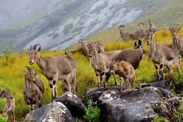
- The park boasts twenty-six recorded mammal species, including the largest population of Nilgiri tahr.
- Other mammals include lion-tailed macaques, gaur, Indian muntjac, sambar deer, golden jackal, jungle cat, wild dog, dhole, leopard, and tiger.
- Eravikulam is home to 132 bird species, featuring endemics such as the black-and-orange flycatcher, Nilgiri pipit, Nilgiri wood pigeon, white-bellied shortwing, Nilgiri flycatcher, and Kerala laughingthrush.
- The park hosts 101 butterfly species, including endemics like the red disk bushbrown and Palni fourring.
Flora:
- Eravikulam National Park encompasses three primary plant communities: grasslands, shrublands, and forests.
About Nilgiri tahr:
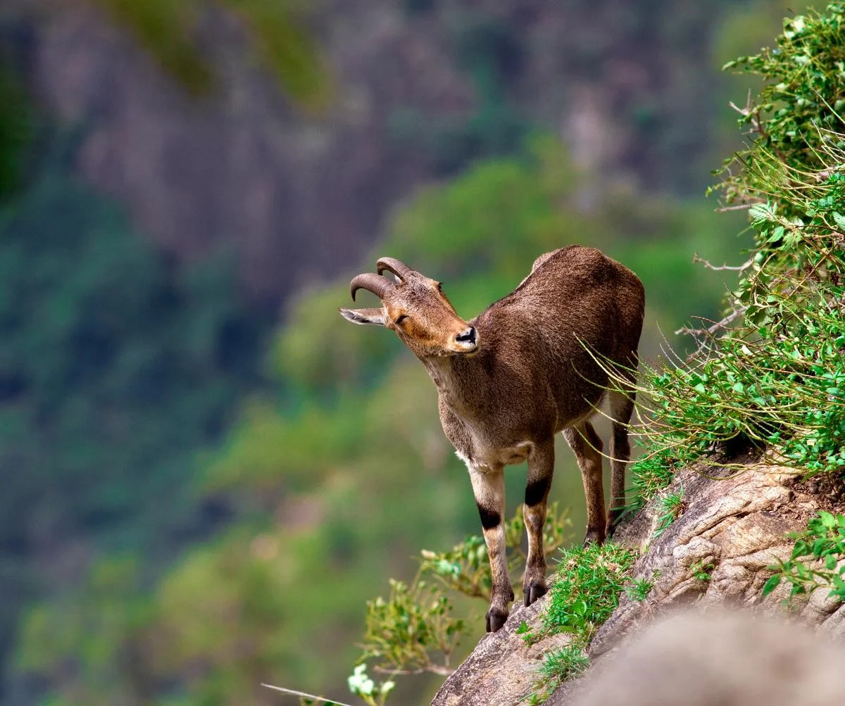
- The Nilgiri tahr (Nilgiritragus hylocrius) is an endangered mountain ungulate native to the Western Ghats mountains in southern India.
- It is the only mountain ungulate in southern India and is also the state animal of Tamil Nadu.
Physical Appearance:
- Stocky goats with short, coarse fur and a bristly mane.
- They have a short grey-brown or dark coat.
- Males are larger, with darker color when mature.
- Curved horns in both sexes; larger in males (up to 40 cm) than females (up to 30 cm).
- Adult males develop a light grey area or ‘saddle’ on their backs, termed ‘saddlebacks’.
Habitat:
- Nilgiri tahrs are adapted to montane grassland habitats and are typically found at elevations ranging from 2,000 to 2,600 meters (6,600 to 8,500 feet) in the Western Ghats.
- Eravikulam National Park houses the largest population, with other concentrations in the Nilgiri Hills, Anamalai Hills, Periyar National Park, Palani Hills, and pockets in the Western Ghats
Geographical Range:
- The species is endemic to the Western Ghats of India and is specifically distributed in the states of Kerala and Tamil Nadu.
Diet:
- Their diet mainly consists of grasses and other vegetation found in their montane habitats.
- They are well-adapted to grazing on steep slopes.
Breeding:
- Breeding typically occurs during the monsoon season, and females give birth to a single offspring after a gestation period of around six months.
Threats:
- Habitat loss due to agriculture, human settlement, and infrastructure development poses a significant threat to Nilgiri tahrs.
- Fragmentation of their habitat also isolates populations, making them more vulnerable.
Conservation Status:
- IUCN Red List: Endangered
- Listed in Schedule I of the Indian Wildlife Protection Act 1972.
Ref: Source
| UPSC IAS Preparation Resources | |
| Current Affairs Analysis | Topperspedia |
| GS Shots | Simply Explained |
| Daily Flash Cards | Daily Quiz |
Frequently Asked Questions (FAQs):
Where is Eravikulam National Park located?
Eravikulam National Park is located along the Western Ghats in the Idukki and Ernakulam districts of Kerala.
What is the highest peak in South India located within Eravikulam National Park?
The highest peak in South India located within Eravikulam National Park is Anamudi, which stands at 2,695 meters.
What species is Eravikulam National Park best known for?
Eravikulam National Park is best known for hosting the largest population of the endangered Nilgiri tahr.
What are the primary threats to the Nilgiri tahr?
The primary threats to the Nilgiri tahr include habitat loss due to agriculture, human settlement, and infrastructure development, as well as habitat fragmentation, which isolates populations and makes them more vulnerable.