

Indian Landslide Susceptibility Map, first of its kind on a national scale, was prepared recently by researchers at IIT Delhi.
About Indian Landslide Susceptibility Map:
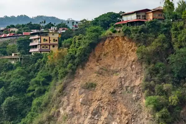
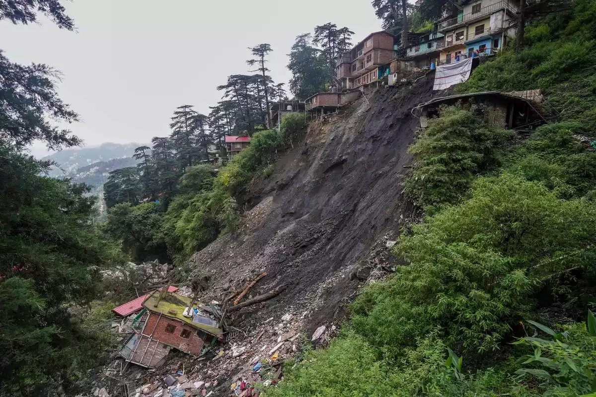
- In late 2023, devastating floods and landslides struck North India due to torrential rains during the northeast monsoon.
- The aftermath emphasized the need for a comprehensive approach to tackle landslides, leading to a significant initiative by IIT Delhi.
- The aim was to identify high-risk areas for landslides, assess vulnerability and allocate resources effectively for mitigation.
- Coverage: It covers the entire country as the first comprehensive national-scale assessment.
- It includes landslide-prone regions like the Himalayan foothills and previously unknown high-risk areas in parts of the Eastern Ghats.
- Utility: It could aid in development of a ‘Landslide Early Warning System’ for India, and made available for public access in user-friendly interface.
- Challenges: Landslides in India are difficult to track, have lesser impact, and scarcity of quality data for machine learning models due to their localized nature.
Data Collection and Analysis:
- 1.5 lakh landslide events in India from various sources were collected, including the Geological Survey of India (GSI).
- Sixteen landslide conditioning factors, such as soil cover, tree density, and proximity to roads were identified.
- To analyze the data, an ensemble machine learning approach was employed to average out the impact of individual models.
- The models projected landslide susceptibility in areas without historical landslide data, enabling a nationwide assessment.
- The result was the ‘Indian Landslide Susceptibility Map,’ providing a high-resolution view of susceptibility at 100m resolution.
Ref: Source
| UPSC IAS Preparation Resources | |
| Current Affairs Analysis | Topperspedia |
| GS Shots | Simply Explained |
| Daily Flash Cards | Daily Quiz |