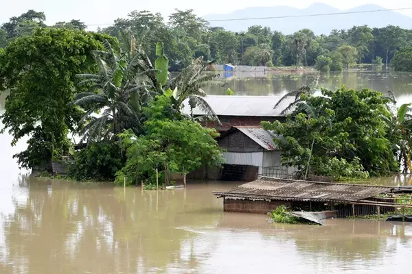
Assam Floods continue to expose the state to environmental and infrastructural challenges.
Content
- Introduction
- What are the geographical and environmental dynamics of Assam floods?
- What is the Historical Context of Floods in Assam?
- How have embankments impacted Assam’s ecology and society?
- What are the challenges and methods for managing Assam floods?
- Conclusion
- Frequently Asked Questions (FAQs)
Introduction
- Assam’s geography includes the eastern Himalayas and dense forests.
- This sets the stage for annual floods that affect its demographics and ecological systems profoundly.
What are the geographical and environmental dynamics of Assam floods?
- Terrain and Climate: It is the eastern Himalayas alongside the aggressive monsoons from the Bay of Bengal that shape Assam’s unique geography.
- This, coupled with heavy sediment deposits from the Himalayas, primes the state for its annual floods.
- River Systems: The Brahmaputra and its tributaries, known for their volatile flow, frequently exceed their bounds, inundating vast tracts of land.
What is the Historical Context of Assam floods?
- Post-Earthquake Changes: The devastating 1950 earthquake dramatically altered the region’s hydrology, intensifying flood frequencies and impacts.
How the government has responded?
- In response, Assam advocated for the construction of embankments, a strategy influenced by global practices and backed by the state and national governments despite early warnings about potential negative impacts.
Garg Committee (1951):
- Appointed in 1951, the Garg Committee advised against building embankments, warning that they could disrupt natural river functions.
- It will potentially cause more harm than good, especially in a sediment-rich environment like Assam.
How have embankments impacted Assam’s ecology and society?
- Environmental Disruptions: Embankments, while initially mitigating flood damage, eventually disrupted natural sedimentation and river drainage processes.
- These changes led to reduced soil fertility and increased reliance on artificial fertilizers.
- Socio-economic Consequences: They also provided temporary relief from flooding, but at the cost of long-term ecological health, leading to more severe consequences when breaches occurred.
What are the challenges and methods for managing Assam floods?
- Reevaluation of Strategies: By the late 20th century, scepticism about the efficacy of embankments grew.
- Reports from bodies like the National Flood Commission underscored the need to reassess flood management tactics, considering the evolving environmental and hydrological realities.
- Current strategies focus less on new constructions and more on improving existing infrastructures and incorporating sustainable practices to enhance resilience against floods.
Conclusion
Assam must integrate a combination of technological advances, ecological conservation, and community-oriented strategies to effectively manage floods. Promoting sustainable land management, bolstering early warning systems, and enhancing community resilience should be prioritized. These steps are not only crucial for Assam but can also serve as valuable lessons for other regions grappling with similar environmental challenges.
Ref: Source
| UPSC IAS Preparation Resources | |
| Current Affairs Analysis | Topperspedia |
| GS Shots | Simply Explained |
| Daily Flash Cards | Daily Quiz |
Frequently Asked Questions (FAQs)
What geographical features contribute to the annual floods in Assam?
The eastern Himalayas and dense forests, along with aggressive monsoons and heavy sediment deposits from the Himalayas, shape Assam’s unique geography and prime the state for its annual floods.
What is meant by ‘ecological systems’?
Ecological systems refer to the complex networks of living organisms and their physical environment, interacting as a functional unit.
What are ’embankments’ and how do they work?
Embankments are raised structures built along riverbanks designed to prevent rivers from overflowing and flooding adjacent lands.
What is hydrology?
Hydrology is the scientific study of the movement, distribution, and quality of water on Earth, including the water cycle, water resources, and environmental watershed sustainability.
What is sedimentation?
Sedimentation is the natural process by which material, carried by water, is deposited as sediment, or residue, building up layers of minerals and organic matter.


