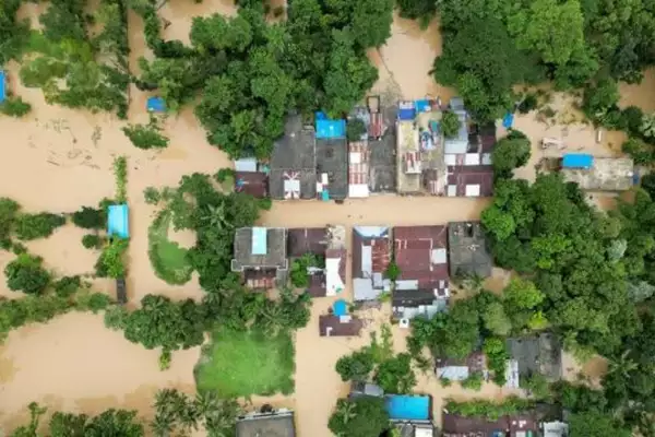
The Ministry of External Affairs recently clarified that the Bangladesh floods were not triggered by release of water from Dumbur dam off Gumti River in Tripura.
About Gumti River:
- The Gumti River originates from Dumur in the northeastern hilly region of Tripura, and flows for about 150 km through the hills before entering Bangladesh near Katak Bazar.
- In Bangladesh, the river meanders through Comilla and Debidwar, eventually merging with the Meghna River at Shapta in Daudkandi upazila.
- The Gumti spans approximately 135 km within Bangladesh, with important tributaries like the Dakatia and distributaries such as the Buri River.
- During the rainy season, its width reaches about 100 meters, with rapid currents, while in winter, it shrinks significantly.
- The river is prone to flash floods, historically earning the name “sorrow of Comilla town.”
- The Bangladesh Water Development Board (BWDB) has implemented several measures, including flood embankments and loop-cuts, to control flooding.
- Notable locations along its banks include Comilla, Mainamati, Burichang, Companiganj, Muradnagar, and Daudkandi.
- The Gumti is tidal up to Daudkandi, but its upstream is free from tidal influences.
Ref: Source
| UPSC IAS Preparation Resources | |
| Current Affairs Analysis | Topperspedia |
| GS Shots | Simply Explained |
| Daily Flash Cards | Daily Quiz |
Frequently Asked Question:
Where does the Gumti River originate?
The Gumti River originates from Dumur in the northeastern hilly region of Tripura, India.
How long is the Gumti River?
The Gumti River flows for about 150 km through India and spans approximately 135 km within Bangladesh, making its total length around 285 km.
Which significant areas does the Gumti River pass through in Bangladesh?
In Bangladesh, the Gumti River passes through notable areas like Comilla, Mainamati, Burichang, Companiganj, Muradnagar, and Daudkandi.


