

The former Prime Minister of Bangladesh has reportedly made several bold claims regarding the United States’ interest in St. Martin’s Island.

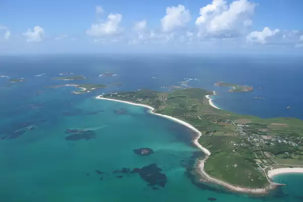
About St Martin’s Island:
- St. Martin’s Island is situated in the northeastern part of the Bay of Bengal.
- It is approximately 9 km south of the Cox’s Bazar-Teknaf peninsula’s tip.
- It is the southernmost part of Bangladesh, which is located west of the northwest coast of Myanmar at the Naf River’s mouth.
- Initially, it was an extension of the Teknaf peninsula but became separated due to submergence.
- Locally known as ‘Narikel Jinjira’ (Coconut Island) and ‘Daruchini Dwip’ (Cinnamon Island).
Physical Characteristics:
- The island covers an area of only 3 km².
- Adjacent to it is Chera Dwip, a smaller island that gets separated at high tide.
Geopolitical Significance:
- In 1974, Bangladesh and Myanmar agreed that St. Martin’s Island would be recognized as Bangladeshi territory.
- Its location near the border between Bangladesh and Myanmar adds to its strategic importance.

Ref: Source
| UPSC IAS Preparation Resources | |
| Current Affairs Analysis | Topperspedia |
| GS Shots | Simply Explained |
| Daily Flash Cards | Daily Quiz |
Frequently Asked Question:
Where is Saint Martin Island?
Saint Martin Island is located in the northeastern part of the Bay of Bengal, south of the Cox’s Bazar-Teknaf peninsula in Bangladesh.
Who owns St Martin Island?
St. Martin Island is a territory of Bangladesh.